-
Welcome to Tacoma World!
You are currently viewing as a guest! To get full-access, you need to register for a FREE account.
As a registered member, you’ll be able to:- Participate in all Tacoma discussion topics
- Communicate privately with other Tacoma owners from around the world
- Post your own photos in our Members Gallery
- Access all special features of the site
 Electric Tacoma Spotted
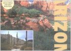 Arizona Trails....anyone want to show me some
 Kb voodoo Remote Start Kit for 2016 - 2017 Tacoma
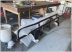 Rock Sliders? Local
 Sound deadening in east valley install wanted
Phoenix Valley to Sedona with OHV trail info
Discussion in 'Arizona' started by mandog, Feb 19, 2021.